Snap, share, protect: Community Science on Shellharbour’s Coast
Myah Garza
26 January 2026, 7:00 PM
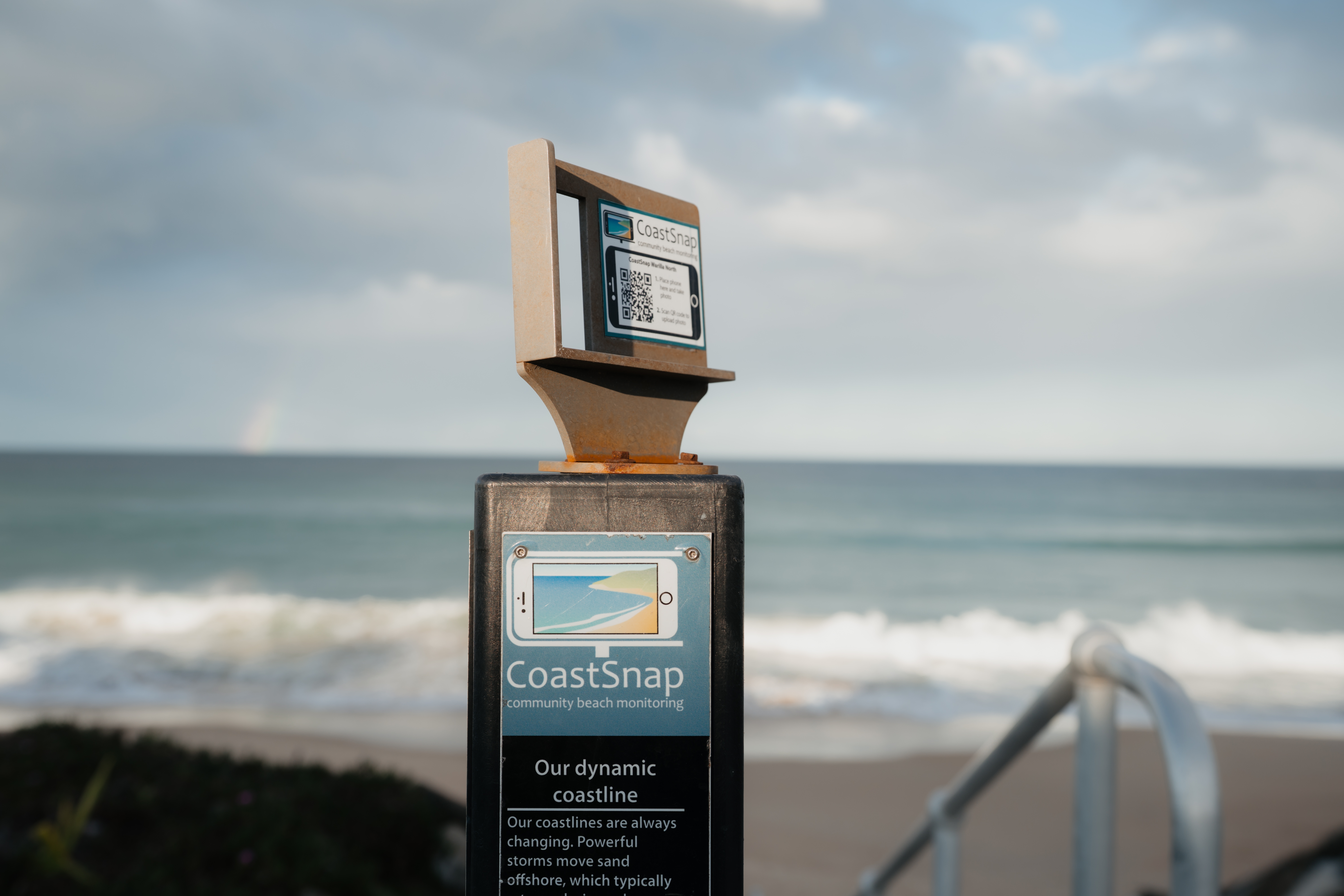 Warilla South Beach CoastSnap station. Photo: Shellharbour City Council.
Looking for a fun reason to hit the beach as the weather warms up? Shellharbour City Council is inviting locals and visitors to take part in its Coastal Monitoring Program by simply snapping a photo.
Through the CoastSnap citizen science initiative, beachgoers can help monitor how Shellharbour’s coastline changes over time.
All it takes is a quick photo at one of the CoastSnap stations located at Gadhu Beach (Shell Cove Southern Breakwall), Warilla South Beach, Windang Island, and Shellharbour North Beach.
The program also includes BeachStat cameras, which capture timelapse imagery to track shoreline movement, erosion and coastal resilience.
Due to extended funding from the NSW Government’s Coastal and Estuary Grants Program, monitoring will continue through to June 2026.
Since launching in 2022, hundreds of community-submitted images and timelapse sequences have been collected, providing valuable data to support better coastal planning and management.
Community participation has been key to building a long-term picture of how Shellharbour’s coastline responds to weather, tides and climate conditions.
Shellharbour Mayor Chris Homer said the program is a great example of science powered by the community.
“Summer is the perfect time to hit the beach, soak up the sun and snap a photo at a CoastSnap station,” he said.
“Every photo helps us understand how our coastline changes over time. It’s a simple way to enjoy the outdoors and make a real difference for our beaches. So grab your sunnies, take a snap and be part of the science.”
NEWS